The Laugavegur Trail – Iceland’s Best Known Hiking Route
| All
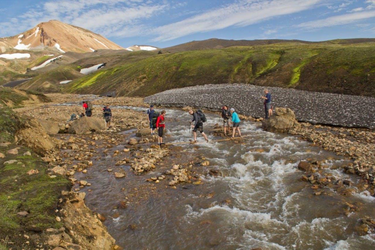
River crossing
The World Famous Laugavegur Trail
Each year the Laugavegur trail attracts adventure seeking hikers from all over the world. And for a good reason! The Laugavegur hiking trail has become one of the world’s best known treks and is one of Icelandic Mountain Guides’ most popular summer tours. The Laugavegur trek is truly an amazing hike. In the five days it takes to hike the 55 km between Landmannalaugar and the valley of Þórsmörk, you experience unbelievable variations in landscape. Beginning in the yellow rhyolite mountains of Landmannalaugar, in the “Fjallabak“ Nature Reserve, or the area “Behind the Mountains”, it takes you past hot springs and waterfalls, over black sand desert decorated with green mountains all the way to the green oasis of Þórsmörk glacier valley sitting at the foot of the famous Eyjafjallajökull volcano.

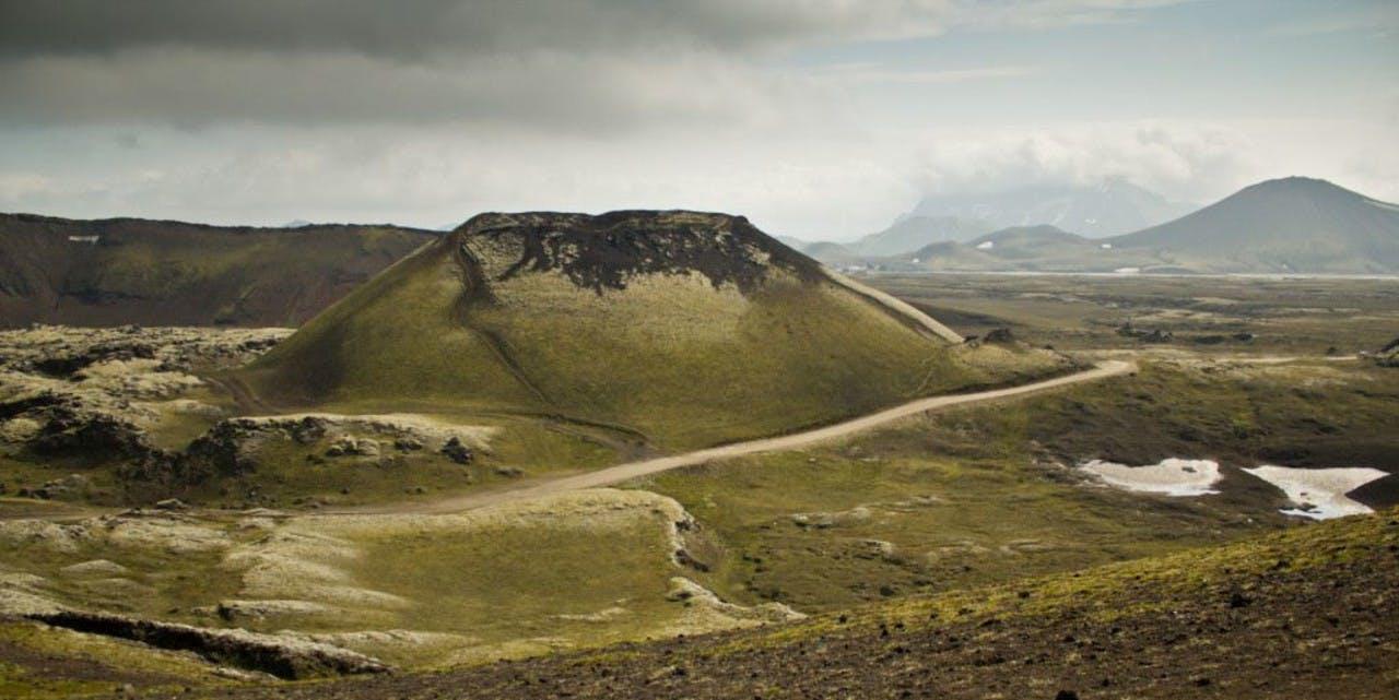
A mossy mountain
On the hike you can either carry all your gear with you or join a tour like ours where all luggage and gear is transported between huts and hikers only need to carry their daypacks. On an organized tour you also get to travel with a professional guide that will show you some of the detours you can make off the main trail, explain everything about the geology en route and last but not least, get you safely across the rivers along the way.
Actually there are other ways to travel the Laugavegur trail. The most extreme run it in a day (the Laugavegur Ultra Marathon has more and more participants every year) but taking your time between huts allows you to enjoy the landscape and the many interesting natural phenomenon that you find along the trail
During the Laugavegur trek most hikers stay in the mountain huts. And they are just that, mountain huts. Nothing fancy – they are just functional, there to provide a warm and dry place to spend the night. The sleeping arrangements are in single or sometimes double bunks that the travellers have to be prepared to share with other hikers!

Hiking up Hrafntinnusker mountain
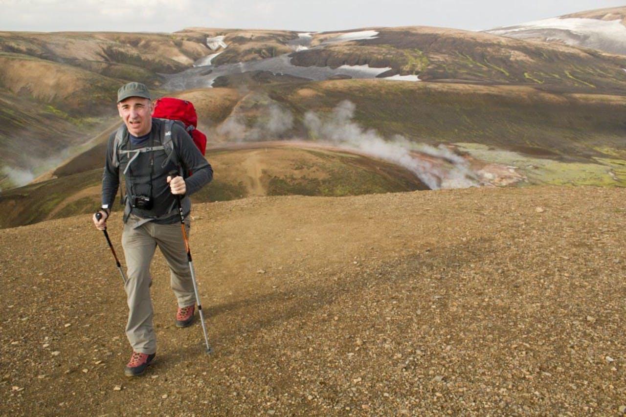
The first leg of the trail is from Landmannalaugar to Hrafntinnusker mountain (or Obsidian Skerry), a rocky mountain top that is also the highest point of the hike. This first day is only about 12 km, but it’s all uphill. On the way, you walk past bubbling hot springs and steaming ground up to the yellow hills above Landmannalaugar. At Stórihver (Big Hot Spring) the climb begins to be steeper and the green moss gives way to rocky ground and often some snow, even in July! Some people take the first two legs in one day but that gives you a long 25 km day!
From Hrafntinnusker, the trail is mostly downhill even though the path goes up and down over gullies and hills, and although the surroundings are moonlike you might find some fragile plant life if you pay special attention. On the second leg we also come across the few first rivers that have to be forded on the way. The first ones are usually not too deep but it is still necessary to take off the hiking boots and put on the river crossing shoes.
The Álftavatn huts sit by the lake Álftavatn (The name refers to Whooper swans that used to be hunted there in the 19th century). The lake sits in a green valley and has high mountains on either side. A beautiful spot to spend the night!
On the third leg, the landscape begins to change dramatically as we leave the greens of Álftavatn and head into the sands of Mælifellssandur. During the first half of this day, the hiking rhythm is broken up a few times with a couple of river crossings but the scenery is incredible. When coming to Emstrur the great canyon of Markarfjótsgljúfur merits a detour to the right of the trail. The river Markarfljót, which is about 100km long, has carved this canyon which at this point is about 200 m deep so from the top you can look down on fulmars (bird species) soaring between the rocky cliffs. A nice evening stroll from the Botnar huts in Emstur to the canyon is also the perfect way to end this day and enjoy this majestic place.

Landmannalaugar - natural hot pool
Emstrur is also the endpoint of the Strútur trail, a hiking route that runs from Eldgjá in the east via southern portion of the Fjallabak area, home of the mountain Strútur and natural hot pool, Strútslaug. This trail is not as well-known as the Laugavegur trail outside of Iceland but still a favorite among locals. It is perfect for those who want to visit the Fjallabak area but want to swerve away from the crowds and take the road less travelled. As of next summer (2014), Icelandic Mountain Guides will also be offering the Strútur trail trekking tour.
The last part of the Laugavegur hike is from Emstur to Þórsmörk, the green glacier valley with wonderful arctic birch all around. As we draw closer to our endpoint the vegetation increases and the occasional tree starts to appear. There is one final challenge before arriving in Þórsmörk, the glacial river Þröngá needs to be crossed. This can be a bit tricky but, with the right crossing techniques everyone comes across safely. The last few kilometers are through the forests of Þórsmörk, a welcoming sight after the rocky landscapes we are coming from. In Þórsmörk the local way to celebrate a great hike is to barbeque a leg of lamb and eat with friends in the bright summer night, and that is how we end our tour. However it is also possible to get a bus to Reykjavík in the same evening.
From Þórsmörk it is possible to continue to hike over the Fimmvörðuháls pass to Skógar in the southern lowlands. This will add another 22 km to your hike. It is possible to make the hike in one day. However, doing it in two days allows you to enjoy the sights along the pass better, such as the craters Móði and Magni that were formed in the first phase of the 2010 eruption of Eyjafjallajökull, and the lava field that emanated from those two.
For those who have less time on their hands or if steaming lava is your main interest, the Fimmvörðuháls trek is a good option, giving you some time to see Þórsmörk before starting the hike.
As for the weather on the trail you can expect all kinds, from crazy rainstorms or some snow in Hrafntinnusker (even in the summer months) to brilliant sunshine that makes the crossing over the Mælifellssandur sand plains best done in shorts and tank tops with loads of sunscreen! In the later parts of summer and early autumn the mercury is more than likely to drop below freezing at night. The same thing goes for Fimmvörðuháls where the weather can change rapidly during the course of the day. So when you come to hike some of the most fabulous trekking trails in Iceland - be prepared and stay safe!
Keep me informed about the Icelandic Mountain Guides Blog
Outdoor adventure in Iceland is our specialty. Subscribe to our free monthly newsletter to learn when to go, what to do and where to have the best adventures in Iceland.